Exposure Map
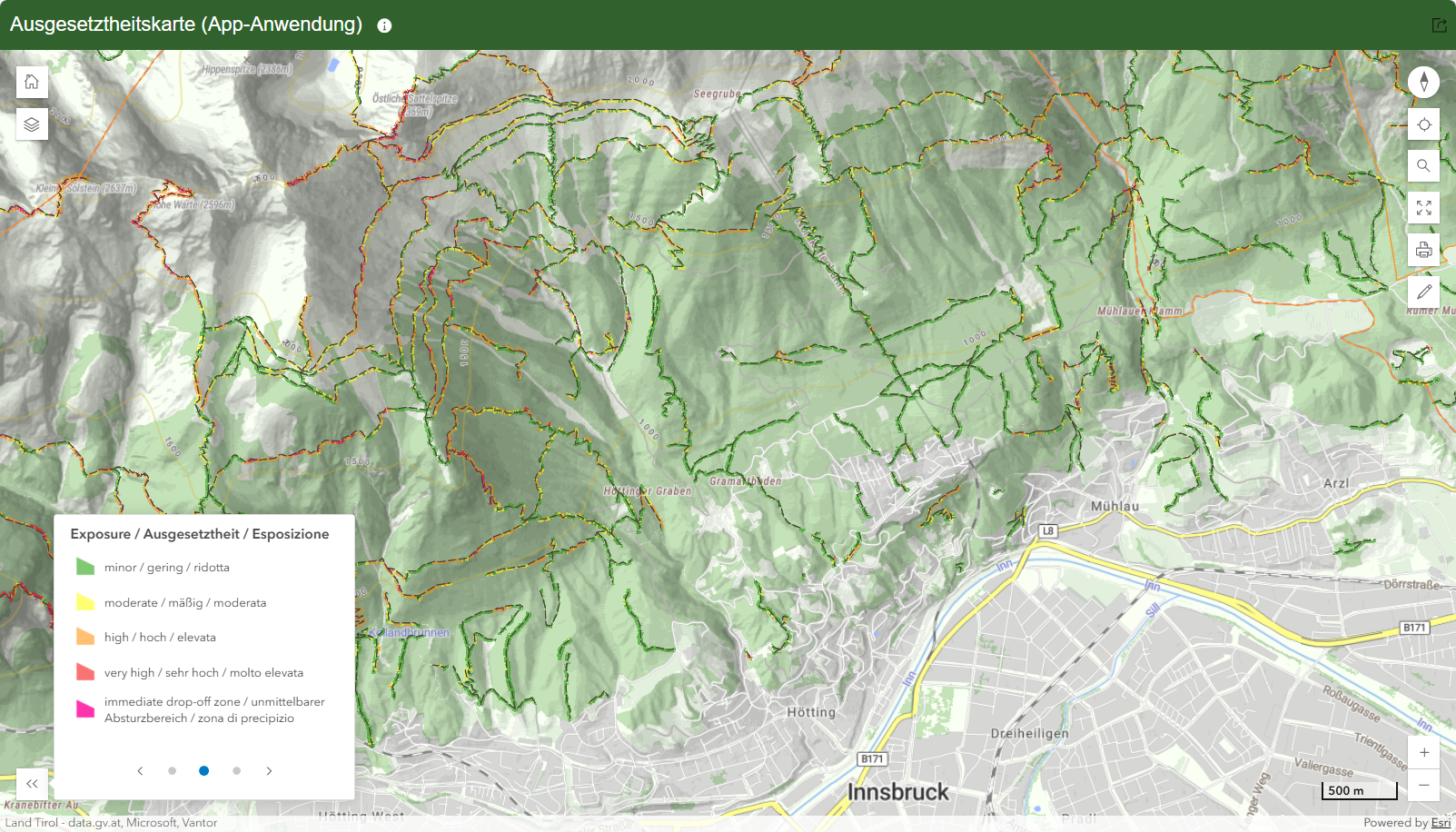
The exposure map provides a clear representation of the terrain exposure along hiking and mountain trails in the Euregio Tyrol - South Tyrol - Trentino. It shows how high the exposure is for trail sections and what the consequences of a fall could be.

The exposure was generated for hiking and mountain trails throughout the entire Euregio, here is a section of the Nordkette north of Innsbruck.
Structure and design
The map was calculated using modern geographic information system (GIS) methods for the entire Euregio Tyrol - South Tyrol - Trentino and supports hikers and mountaineers in more conscious tour planning.
The map depicts four classes of exposure - from minor (green) to moderate (yellow), high (orange), and very high (red). Potential immediate drop-off zones are additionally highlighted in pink. The transitions between the classes are to be understood as gradual.
The exposure map represents one partial aspect of a comprehensive trail classification. Aspects such as technical difficulty, trail surface, or existing safety measures are not included. Further information on trail classifications, comparisons, and a new concept for separating the criteria can be found on the Homepage on trail classifications.
Further information on the method, legend, application, and evaluation can be found on the Homepage on the exposure map.

Cooperations


Our regions